


, 19.06.18
The core forests across the country, including those that are protected, are turning from green to brown, a worrying phenomenon that scientists say is due to more than seasonal variations
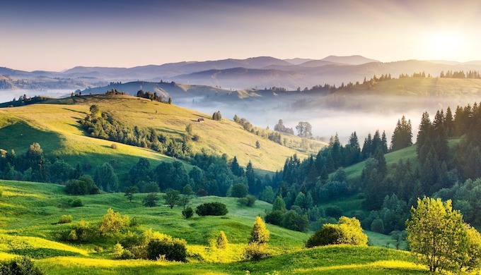
Forests are no longer remaining green in India (Photo by Sathish Kumar Periyasamy)
As much as 4.6 million hectares of forests in India are browning, according to a new study by the Hyderabad-based National Remote Sensing Centre (NRSC) of the Indian Space Research Organisation.
The NRSC measured these changes in colour in 14 types of forest — from wet evergreen to thorn — between 2001 and 2014. It employed the Normalised Difference Vegetation Index (NDVI), a simple graphical indicator that can be used to analyse remote sensing measurements from a space platform, and assess whether the target being observed contains live green vegetation or not.
“Significant negative changes in the seasonal greenness were found to be highest over tropical moist deciduous forest (20,67,350 ha) followed by tropical dry deciduous (14,07,730 ha) and tropical wet evergreen (5,77,430 ha),” the study says. The seasonal greenness of mangrove cover has also declined by 15%, mainly in the Sundarbans in West Bengal.
For the first time, the NRSC used satellite data to monitor such changes. The study of cyclic and seasonal natural phenomena in relation to climate and plant life can throw light on the process of forest growth and decline.
Hotspots in danger
Worryingly, the study also found that among the hotspots where forests have been turning brown were wildlife sanctuaries, which are better protected. The Simlipal wildlife sanctuary in Odisha was the worst off, with 48,600 ha, followed by the Rajaji National Park in Uttarakhand and Achanakmar sanctuary in Chhattisgarh.
“The present study demonstrated the capability of satellite observations to find out persistent changes in the highly dynamic parameter like forest greenness over decadal scale,” it said. “The study also reported large protected areas experiencing spatially coherent significant negative change of seasonal greenness. Hence, the results of the present study could be useful in prioritisation and planning of conservation measures of forests of India.”
The NRSC study follows others. In 2017, three scholars of South Asian origin in the US and Israel, including Kamal S. Bawa, published a study titled Widespread Climate Changes in the Himalayas and Associated Changes in Local Ecosystems. They studied the Himalayas across Pakistan, Nepal, Bhutan and north-western and north-eastern India, a 3,000 km arc, which covered 750,000 sq. km. The mountain chain provides water to 1.4 billion people.
They pointed out that despite the ecological significance of this chain, not much was known about actual changes in the two most critical climatic variables: temperature and rainfall. Nor was it known how changes in these parameters might impact ecosystems, including how periodic plant life cycle events are influenced by seasonal and inter-annual variations in climate.
By analysing temperature and rainfall data, and NDVI values from remotely sensed imagery, they reported significant changes in temperature, rainfall, and vegetation changes across the Himalayas between 1982 and 2006.
It was the first time that large-scale climatic and vegetation changes at the landscape level had been documented for the Himalayas. “The rate of warming in the Himalayas is greater than the global average, confirming that the Himalayas are among the regions most vulnerable to climate change,” they concluded.
Implications not discussed
Commenting on the NRSC study, Bawa from the University of Massachusetts, Boston and the Bangalore-based Ashoka Trust for Research in Ecology and the Environment (ATREE), told indiaclimatedialogue.net, “I do think it is a significant piece of work but not a path-breaker. I am surprised that although the results are very important, the authors do not fully discuss the implications of their work.”
“There is no mention of the possible causes of the trends they observed. Nor do they mention the implications of their findings. I was surprised that the landmark work of Jagdish Krishnaswamy on the browning of the montane forest is not mentioned,” he said. “Since the authors do not tell us the possible causes of the trends they observed, I cannot say if the results are comparable to Krishnaswamy’s or to our work in the Himalayas.”
Bawa was awarded the Linnean Medal in Botany in London this May. He was recognised for his pioneering research on the evolution of tropical plants, tropical deforestation and for work on the biodiversity of forests in Central America, the Western Ghats and the Eastern Himalaya.
“It is apparent from the NRSC’s work along with various other recent studies that parts of South Asian forests have been drying up during the recent decade which is alarming from the forest conservation point of view,” Sangeeta Sarmah, from the Chinese Academy of Sciences in Beijing, told indiaclimatedialogue.net. “However, this work has not discussed the factors causing the browning of the Indian forests, which would have been more interesting to learn about. The study exposed substantial negative changes in forest core areas, which should be backed up by some ground observations, as it is a significant revelation. The authors also did not discuss the implications of their work. Some more in-depth researches are needed regarding vegetation dynamics and various drivers, specifically for this region, as many issues are poorly understood in this region.”
This February, Sarmah and two Chinese colleagues published a study titled “Satellite view of seasonal greenness trends and controls in South Asia. They chose South Asia because it was “one of the most remarkable regions for changing vegetation greenness, accompanying its major expansion of agricultural activities, especially irrigated farming. The influence of the monsoon climate on the seasonal trends and anomalies of vegetation greenness is poorly understood in this area.”
Vegetation activity
They used NDVI to investigate various changes in vegetation activity during the summer and winter monsoon seasons and among irrigated croplands, rain-fed croplands and natural vegetation areas between 1982 and 2013. Their most interesting findings were the striking differences of the greening/browning between seasons and among the land use and land cover changes. They also explored the climate and land use cover change as the drivers of the seasonal and long term NDVI variations over the study area.
“The winter monsoon contributed larger variability to the overall vegetation changes in South Asia, which is the major finding of this study,” they concluded. “The increased productivity over irrigated croplands contributed to the greening of South Asia during the winter monsoon season. Meanwhile, significant browning occurred in the Western Ghats, northeastern India and the Himalayan foothills since 2000, and changes were observed during the same season.”
In 2013, Jagdish Krishnaswamy, also from ATREE, was the lead author of a paper titled Consistent response of vegetation dynamics to recent climate change in tropical mountain regions, which found that global climate change has emerged as a major driver of ecosystem change. The authors chose 47 Protected Areas (PAs) with elevations 1,000 metres above mean sea level in five continental regions in Africa, Central America, South America, South Asia, and Southeast Asia.
They analysed decadal-scale trends and seasonal cycles of vegetation greenness, using monthly time series of satellite greenness (NDVI) and climate data between 1982 and 2006 for these mountain protected areas in five biodiversity hotspots.
Strong browning trends
These showed mild greening trends, followed by a reversal to stronger browning trends around the mid-1990s. They found that temperatures were rising, but there was only a marginal change in rainfall.
“We found residual browning and greening trends in all regions, which indicate that factors other than temperature and precipitation also influence vegetation dynamics. Browning rates became progressively weaker with increase in elevation,” the study said. “Tropical mountain vegetation is considered sensitive to climatic changes, so these consistent vegetation responses across widespread regions indicate persistent global-scale effects of climate warming and associated moisture stresses.”
“The biggest weakness of the NRSC study is that the greening and browning are not analysed in relation to climate or other drivers; the attribution to any of these factors is difficult,” Krishnaswamy told indiaclimatedialogue.net. “Changes inside protected areas are assumed to be due to drivers such as climate variability or climate change, but in some protected areas, management practices or changes in fire regime have been known to influence greening and browning trends. The analyses of browning in some areas cannot be delimited from greening in other areas.”
“The role of climate change on browning is completely missing,” he said. “Over 30-40 years, for instance, the El Niño effect on vegetation in a specific area has to be examined.”
In 2010, B.R. Ramesh from the French Institute in Pondicherry, with other authors from France and India, published a study on Soil carbon stocks, deforestation and land-cover changes in the Western Ghats Biodiversity Hotspot. Habitat loss and organic carbon stock in soil variations linked to land-cover change were estimated over two decades in the most densely populated biodiversity hotspot in the world, to assess the possible influence of conservation practices on the protection of soil organic carbon (SOC).
For a study area of 88,484 sq. km, 70% of which lay inside the Western Ghats Biodiversity Hotspot, land-cover maps for 1977 and 1999 were built from various data sources, including remote sensing images and ecological forest maps.
Unexpectedly, their results showed that despite on-going deforestation at the rate of 29 sq. km a year, overall SOC stock was maintained. “But a closer examination of spatial differences showed that soil carbon losses in deforested areas were compensated by sequestration elsewhere, mainly in recent plantations and newly irrigated croplands,” the study said. “This suggests that more carbon sequestration in soils could be achieved in the future through appropriate wasteland management. It is also expected that increasing concerns about biodiversity loss will favour more conservation and reinforce the already prevailing protective measures, thus further maintaining carbon stocks.”

Đăng nhận xét